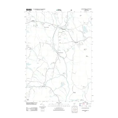
2012 Map of Londonderry
USGS Topo · Published 2012About this map
Londonderry and its surrounding Windham County villages are defined by the winding course of the West River and the Winhall River, which converge south of the primary settlement. This 2012 survey illustrates the region's long-standing reliance on seasonal tourism and outdoor recreation, featuring the Magic Mountain Winter Sports Area, Viking Winter Sports Area, and the Nordic Cross Country Ski Area. For genealogists, the map is a dense record of early burial grounds, preserving the locations of family and municipal plots such as Osgood Chubbuck Cem, Staples Cem, and Riverside Cem. The landscape transitions from the developed corridors of South Londonderry and Rawsonville to the protected heights of Glebe Mountain and the Green Mountain National Forest. Notable water features like Hamilton Falls and Ball Mountain Reservoir further emphasize the area's geography of high-elevation streams and managed reservoirs.
Find a feature on this map
127 named features on this map. Tap any name to fly to it.
Don’t see what you’re looking for? This feature index may not catch every label — zoom into the map to look around manually.
Map Details
Editions of this 2012 Londonderry Map
This is the sole edition of this map. No revisions or reprints were ever made.
Other maps of this area

1893 · Wallingford
USGS Topo · 1:62,500

1894 · Londonderry
USGS Topo · 1:62,500

1899 · Londonderry
USGS Topo · 1:62,500

1928 · Ludlow
USGS Topo · 1:48,000

1929 · Ludlow
USGS Topo · 1:62,500

1930 · Saxtons River
USGS Topo · 1:48,000

1932 · Ludlow
USGS Topo · 1:62,500

1933 · Saxtons River
USGS Topo · 1:62,500

1950 · Glens Falls
USGS Topo · 1:250,000

1955 · Wallingford
USGS Topo · 1:62,500