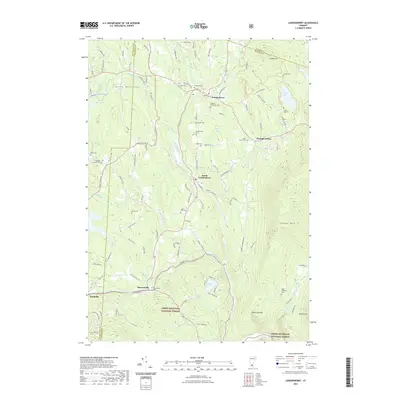
2021 Map of Londonderry
USGS Topo · Published 2021About this map
The West River carves a deep path through these Vermont highlands, anchoring a series of valley settlements from Londonderry and South Londonderry down to Rawsonville and Bondville. The landscape is defined by the high peaks of Glebe Mtn and Shatterack Mtn, with much of the southern terrain protected within the Green Mountain National Forest. Genealogists will find a high density of small family and community burial grounds, including the Osgood - Chubbuck Cem, Middletown Cem, and Riverside Cem. The map documents a rugged interior geography where the mountains dictated the placement of early roads and hamlets. Natural landmarks such as Hamilton Falls and Lowell Lake underscore the area's transition into a modern recreation destination while maintaining its traditional rural character.
Find a feature on this map
117 named features on this map. Tap any name to fly to it.
Don’t see what you’re looking for? This feature index may not catch every label — zoom into the map to look around manually.
Map Details
Editions of this 2021 Londonderry Map
This is the sole edition of this map. No revisions or reprints were ever made.
Other maps of this area

1893 · Wallingford
USGS Topo · 1:62,500

1894 · Londonderry
USGS Topo · 1:62,500

1899 · Londonderry
USGS Topo · 1:62,500

1928 · Ludlow
USGS Topo · 1:48,000

1929 · Ludlow
USGS Topo · 1:62,500

1930 · Saxtons River
USGS Topo · 1:48,000

1932 · Ludlow
USGS Topo · 1:62,500

1933 · Saxtons River
USGS Topo · 1:62,500

1950 · Glens Falls
USGS Topo · 1:250,000

1955 · Wallingford
USGS Topo · 1:62,500