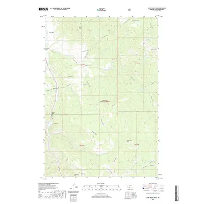
2020 Map of Lone Indian Peak
USGS Topo · Published 2020About this map
Lone Indian Peak stands as a central landmark within this portion of the Gallatin National Forest, where the high-altitude topography is defined by a complex network of drainages and ridges. The Gallatin River cuts through the western edge of the quadrangle, shadowed by Gallatin Rd and providing a corridor for small settlements like Red Cliff and Lemondrop. Further east, the land rises into significant peaks and plateaus, including Eaglehead Mtn and the appropriately named Porcupine Meadows. High-country water features are a notable characteristic of this landscape, with the Golden Trout Lakes tucked beneath the Hidden Lake Divide and Ramshorn Lake situated on the eastern boundary. This area is heavily influenced by its drainage systems, with Porcupine Creek and its many numbered tributaries—First, Second, Third, and Fourth creeks—carving out the interior valleys. Interesting localized landmarks like Prohibition Rock and Burnt Top hint at the unique cultural and natural history embedded in these mountains.
Find a feature on this map
46 named features on this map. Tap any name to fly to it.
Don’t see what you’re looking for? This feature index may not catch every label — zoom into the map to look around manually.
Map Details
Editions of this 2020 Lone Indian Peak Map
This is the sole edition of this map. No revisions or reprints were ever made.
Other maps of this area

1888 · Three Forks
USGS Topo · 1:250,000

1894 · Three Forks
USGS Topo · 1:250,000

1895 · Three Forks
USGS Topo · 1:250,000

1947 · Bozeman
USGS Topo · 1:250,000

1948 · Bozeman
USGS Topo · 1:250,000

1950 · Spanish Peaks
USGS Topo · 1:62,500

1950 · Sphinx Mountain
USGS Topo · 1:62,500

1955 · Bozeman
USGS Topo · 1:250,000

1955 · Garnet Mountain
USGS Topo · 1:62,500

1955 · Crown Butte
USGS Topo · 1:62,500