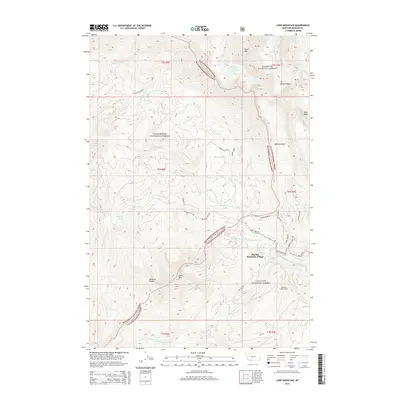
2014 Map of Lone Mountain
USGS Topo · Published 2014About this map
Big Sky Mountain Village serves as the focal point for this high-altitude landscape, where the Madison Range meets the developed ski infrastructure of southwest Montana. The terrain is dominated by the towering profile of Lone Mtn and the jagged Spanish Peaks to the north, creating a complex drainage network that feeds the Middle Fork W Fork Gallatin River. This 2014 survey documents the modern layout of the resort area, including the concentration of alpine lakes such as Lake Levinsky and the Ulerys Lakes.
Find a feature on this map
85 named features on this map. Tap any name to fly to it.
Don’t see what you’re looking for? This feature index may not catch every label — zoom into the map to look around manually.
Map Details
Editions of this 2014 Lone Mountain Map
This is the sole edition of this map. No revisions or reprints were ever made.
Other maps of this area

1888 · Three Forks
USGS Topo · 1:250,000

1894 · Three Forks
USGS Topo · 1:250,000

1895 · Three Forks
USGS Topo · 1:250,000

1947 · Bozeman
USGS Topo · 1:250,000

1948 · Bozeman
USGS Topo · 1:250,000

1949 · Ennis
USGS Topo · 1:62,500

1950 · Cameron
USGS Topo · 1:62,500

1950 · Spanish Peaks
USGS Topo · 1:62,500

1950 · Sphinx Mountain
USGS Topo · 1:62,500

1955 · Bozeman
USGS Topo · 1:250,000