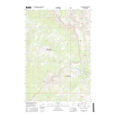
2017 Map of Lone Mountain
USGS Topo · Published 2017About this map
Lone Mtn and the high alpine terrain of the Madison Range dominate this landscape within the Gallatin National Forest and Beaverhead National Forest. This 2017 survey shows the modern footprint of Big Sky, where roads like Diamond Hitch Rd and Mountain Loop Rd weave through the lower elevations near Lake Levinsky. The drainage patterns are clearly defined, with the Middle Fork W Fork Gallatin River and S Fork W Fork Gallatin River carving through the southeast. Higher elevations reveal a complex system of glacial features and high-altitude water bodies, including Ullerys Lakes, Beehive Lake, and the prominent Spanish Peaks. This map serves as a primary reference for the recreational and residential development surrounding the peaks, contrasting the remote wilderness of Bear Basin with the growing infrastructure at the base of the mountains.
Find a feature on this map
48 named features on this map. Tap any name to fly to it.
Don’t see what you’re looking for? This feature index may not catch every label — zoom into the map to look around manually.
Map Details
Editions of this 2017 Lone Mountain Map
This is the sole edition of this map. No revisions or reprints were ever made.
Other maps of this area

1888 · Three Forks
USGS Topo · 1:250,000

1894 · Three Forks
USGS Topo · 1:250,000

1895 · Three Forks
USGS Topo · 1:250,000

1947 · Bozeman
USGS Topo · 1:250,000

1948 · Bozeman
USGS Topo · 1:250,000

1949 · Ennis
USGS Topo · 1:62,500

1950 · Cameron
USGS Topo · 1:62,500

1950 · Spanish Peaks
USGS Topo · 1:62,500

1950 · Sphinx Mountain
USGS Topo · 1:62,500

1955 · Bozeman
USGS Topo · 1:250,000