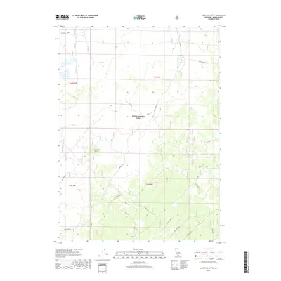
2018 Map of Lone Pine Butte
USGS Topo · Published 2018About this map
Lone Pine Butte and its surrounding high-altitude plateaus define this corner of the Modoc National Forest. This 2018 survey reveals a landscape largely managed for water and range, characterized by the Dalton Reservoir and the drainage of Mowitz Cr. The area is interlaced with a complex network of forest service routes and spurs, such as Boles Spur and S W One, which facilitate access to remote landmarks like Badger Well and Davis Spring. The presence of Potter Pasture and various named spurs indicates a terrain used for seasonal grazing and forest management, where small water features like Lone Pine Lake provide critical points of interest in an otherwise sparse volcanic landscape.
Find a feature on this map
26 named features on this map. Tap any name to fly to it.
Don’t see what you’re looking for? This feature index may not catch every label — zoom into the map to look around manually.
Map Details
Editions of this 2018 Lone Pine Butte Map
This is the sole edition of this map. No revisions or reprints were ever made.
Other maps of this area

1886 · Alturas
USGS Topo · 1:250,000

1886 · Modoc Lava Bed
USGS Topo · 1:250,000

1892 · Modoc Lava-Bed
USGS Topo · 1:250,000

1892 · Alturas
USGS Topo · 1:250,000

1951 · Clear Lake Reservoir
USGS Topo · 1:62,500

1952 · Hackamore
USGS Topo · 1:62,500

1954 · Alturas
USGS Topo · 1:250,000

1958 · Alturas
USGS Topo · 1:250,000

1962 · Alturas
USGS Topo · 1:250,000

1962 · Steele Swamp
USGS Topo · 1:62,500