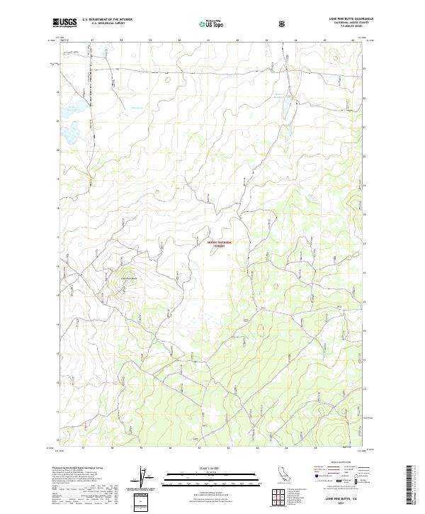
2021 Map of Lone Pine Butte
USGS Topo · Published 2021About this map
Modoc National Forest encompasses the majority of this high-elevation landscape, where the volcanic profile of Lone Pine Butte serves as a prominent geographic anchor. The area is defined by its strategic water resources, including the isolated Lone Pine Lake and the engineered waters of Dalton Reservoir, which support the high-desert ecology of Modoc County. Historical infrastructure is evident in the presence of OTH Radar installations and the path of Boles, indicating the land's transition from forest management to modern utility. Seasonal drainages such as Mowitz Cr and reliable points like Davis Spring further highlight the critical role of water in this arid environment, while the grid of township boundaries across T44N and T45N reflects the structured public land survey system common to this part of northern California.
Find a feature on this map
12 named features on this map. Tap any name to fly to it.
Don’t see what you’re looking for? This feature index may not catch every label — zoom into the map to look around manually.
Map Details
Editions of this 2021 Lone Pine Butte Map
This is the sole edition of this map. No revisions or reprints were ever made.
Other maps of this area

1886 · Alturas
USGS Topo · 1:250,000

1886 · Modoc Lava Bed
USGS Topo · 1:250,000

1892 · Modoc Lava-Bed
USGS Topo · 1:250,000

1892 · Alturas
USGS Topo · 1:250,000

1951 · Clear Lake Reservoir
USGS Topo · 1:62,500

1952 · Hackamore
USGS Topo · 1:62,500

1954 · Alturas
USGS Topo · 1:250,000

1958 · Alturas
USGS Topo · 1:250,000

1962 · Alturas
USGS Topo · 1:250,000

1962 · Steele Swamp
USGS Topo · 1:62,500