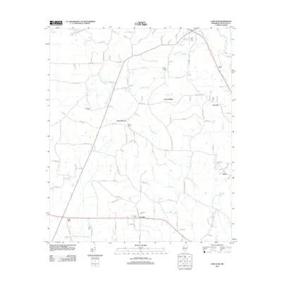
2012 Map of Lone Star
USGS Topo · Published 2012About this map
Lone Star and the surrounding rural pockets of Covington County are defined by a network of family-held cemeteries and small crossroads settlements. This 2012 survey reveals a landscape where community life is anchored by locations like Mount Pleasant, Friendship, and Cooley Springs. These nodes are often identified by their namesake burial grounds, such as Friendship Cem and Cooley Springs Cem, which serve as vital landmarks for genealogists and local historians tracing family lineages in this part of Mississippi.
Find a feature on this map
111 named features on this map. Tap any name to fly to it.
Don’t see what you’re looking for? This feature index may not catch every label — zoom into the map to look around manually.
Map Details
Editions of this 2012 Lone Star Map
This is the sole edition of this map. No revisions or reprints were ever made.
Other maps of this area

1953 · Hattiesburg
USGS Topo · 1:250,000

1958 · Hattiesburg
USGS Topo · 1:250,000

1970 · Prentiss East
USGS Topo · 1:24,000

1970 · Mount Carmel
USGS Topo · 1:24,000
1971 · Mendenhall SE
USGS Topo · 1:24,000

1974 · Lone Star
USGS Topo · 1:24,000

1974 · Williamsburg
USGS Topo · 1:24,000

1974 · Collins
USGS Topo · 1:24,000

1974 · Lake Mike Connor
USGS Topo · 1:24,000

1975 · Mize
USGS Topo · 1:24,000