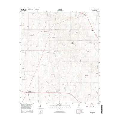
2015 Map of Lone Star
USGS Topo · Published 2015About this map
Lone Star and the surrounding rural communities of Covington County are defined by a network of family-linked landmarks and small settlements. The landscape is marked by numerous historic burial grounds, including Lone Star Cem, Friendship Cem, and Saint Paul Cem, which offer significant value for genealogical research in this part of Mississippi. The terrain is bisected by several watercourses such as Terrible Cr, McKinnis Cr, and Okatoma Creek, which have historically influenced the placement of homes and road networks.
Find a feature on this map
92 named features on this map. Tap any name to fly to it.
Don’t see what you’re looking for? This feature index may not catch every label — zoom into the map to look around manually.
Map Details
Editions of this 2015 Lone Star Map
This is the sole edition of this map. No revisions or reprints were ever made.
Other maps of this area

1953 · Hattiesburg
USGS Topo · 1:250,000

1958 · Hattiesburg
USGS Topo · 1:250,000

1970 · Prentiss East
USGS Topo · 1:24,000

1970 · Mount Carmel
USGS Topo · 1:24,000
1971 · Mendenhall SE
USGS Topo · 1:24,000

1974 · Lone Star
USGS Topo · 1:24,000

1974 · Williamsburg
USGS Topo · 1:24,000

1974 · Collins
USGS Topo · 1:24,000

1974 · Lake Mike Connor
USGS Topo · 1:24,000

1975 · Mize
USGS Topo · 1:24,000