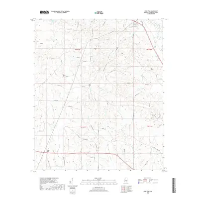
2018 Map of Lone Star
USGS Topo · Published 2018About this map
Mount Olive anchors the northern reaches of this Covington County landscape, where the headwaters of several drainages begin their descent through the piney woods of southern Mississippi. The settlement of Lone Star and the rail-aligned community of Arbo define the local geography, connected by a network of rural routes like Dan Easterling Rd and Cooley Springs Coulter Rd. This 2018 survey reveals a territory dense with ancestral markers, featuring numerous community burial grounds such as Friendship Cem, Oakdale Cem, and Mount Pleasant Cem.
Find a feature on this map
80 named features on this map. Tap any name to fly to it.
Don’t see what you’re looking for? This feature index may not catch every label — zoom into the map to look around manually.
Map Details
Editions of this 2018 Lone Star Map
This is the sole edition of this map. No revisions or reprints were ever made.
Other maps of this area

1953 · Hattiesburg
USGS Topo · 1:250,000

1958 · Hattiesburg
USGS Topo · 1:250,000

1970 · Prentiss East
USGS Topo · 1:24,000

1970 · Mount Carmel
USGS Topo · 1:24,000
1971 · Mendenhall SE
USGS Topo · 1:24,000

1974 · Lone Star
USGS Topo · 1:24,000

1974 · Williamsburg
USGS Topo · 1:24,000

1974 · Collins
USGS Topo · 1:24,000

1974 · Lake Mike Connor
USGS Topo · 1:24,000

1975 · Mize
USGS Topo · 1:24,000