
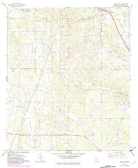
1974 Map of Lone Star
USGS Topo · Published 1978About this map
The Illinois Central Gulf railroad corridor anchors the northeastern corner of this 1970s survey, connecting the town of Mount Olive and the smaller station of Arbo. The landscape is defined by the headwaters of several drainage systems, including Terrible Creek and Little Terrible Creek, which carve through the terrain south of the railroad. Rural life is centered around numerous country churches and cemeteries, such as the Lone Star Cem near the community of Lone Star.
Find a feature on this map
30 named features on this map. Tap any name to fly to it.
Don’t see what you’re looking for? This feature index may not catch every label — zoom into the map to look around manually.
Map Details
Editions of this 1974 Lone Star Map
2 editions found
Other maps of this area

1953 · Hattiesburg
USGS Topo · 1:250,000

1958 · Hattiesburg
USGS Topo · 1:250,000

1970 · Prentiss East
USGS Topo · 1:24,000

1970 · Mount Carmel
USGS Topo · 1:24,000
1971 · Mendenhall SE
USGS Topo · 1:24,000

1974 · Williamsburg
USGS Topo · 1:24,000

1974 · Collins
USGS Topo · 1:24,000

1974 · Lake Mike Connor
USGS Topo · 1:24,000

1975 · Mize
USGS Topo · 1:24,000
1975 · Magee South
USGS Topo · 1:24,000