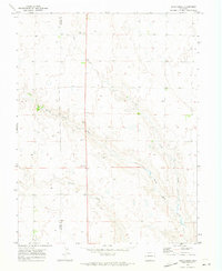
1970 Map of Long Creek
USGS Topo · Published 1973About this map
The rolling plains of eastern Colorado are defined here by a network of ephemeral watercourses that converge along the boundary between Elbert Co and Lincoln Co. In this high-plains landscape, water is the primary architect of the terrain, with Long Creek carving a distinct valley as it trends toward the southeast. The map reveals a sparse, rural pattern of development characteristic of the era, where isolated wells and section lines dictate the human footprint. These survey lines often intersect the winding paths of North Rush Creek and Apache Creek, illustrating the challenges of land management in an arid environment. Near the center of the sheet, a solitary Gravel Pit indicates localized resource extraction, serving as a rare industrial marker in a region dominated by wide-open ranching and agricultural lands.
Find a feature on this map
5 named features on this map. Tap any name to fly to it.
Don’t see what you’re looking for? This feature index may not catch every label — zoom into the map to look around manually.
Map Details
Editions of this 1970 Long Creek Map
This is the sole edition of this map. No revisions or reprints were ever made.
Other maps of this area

1889 · Sanborn
USGS Topo · 1:125,000

1891 · Sanborn
USGS Topo · 1:125,000

1891 · Limon
USGS Topo · 1:125,000

1892 · Limon
USGS Topo · 1:125,000

1893 · Sanborn
USGS Topo · 1:125,000

1954 · Limon
USGS Topo · 1:250,000

1954 · Lamar
USGS Topo · 1:250,000

1957 · Limon
USGS Topo · 1:250,000

1958 · Limon
USGS Topo · 1:250,000

1958 · Lamar
USGS Topo · 1:250,000