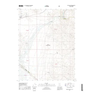
2018 Map of Long Dry Canyon
USGS Topo · Published 2018About this map
The West Walker River meanders through the northwest corner of this Nevada landscape, where the agricultural infrastructure of the Antelope Valley meets the rising terrain of the Wellington Hills. This high-desert region is defined by a sophisticated water management system designed to support ranching, featuring the Saroni Canal, Topaz Canal, and the Highline Ditch. To the north, the residential layout of Topaz Ranch Estates stands in contrast to the protected wilderness of the Toiyabe National Forest that dominates the central and southern portions of the map. The rugged topography is etched with numerous named features such as Powell Trough, Hoye Canyon, and Risue Canyon, illustrating the complex drainage patterns of the Great Basin. Historical access across the river is marked by the Hoye Bridge, providing a fixed point of reference in an area otherwise characterized by sweeping public lands and remote desert basins.
Find a feature on this map
30 named features on this map. Tap any name to fly to it.
Don’t see what you’re looking for? This feature index may not catch every label — zoom into the map to look around manually.
Map Details
Editions of this 2018 Long Dry Canyon Map
This is the sole edition of this map. No revisions or reprints were ever made.
Other maps of this area

1889 · Markleeville
USGS Topo · 1:125,000

1891 · Markleeville
USGS Topo · 1:125,000

1891 · Wellington
USGS Topo · 1:125,000

1893 · Markleeville
USGS Topo · 1:125,000

1893 · Wellington
USGS Topo · 1:125,000

1948 · Walker Lake
USGS Topo · 1:250,000

1956 · Desert Creek Peak
USGS Topo · 1:62,500

1956 · Topaz Lake
USGS Topo · 1:62,500

1957 · Walker Lake
USGS Topo · 1:250,000

1957 · Wellington
USGS Topo · 1:62,500