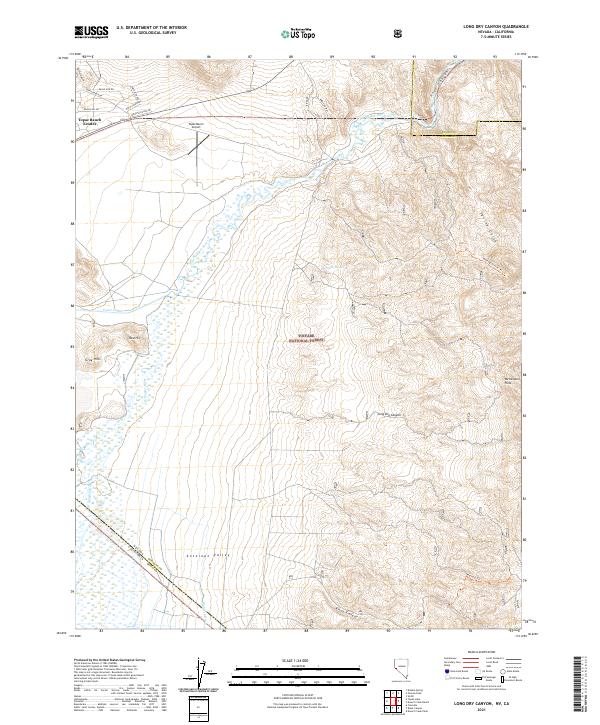
2021 Map of Long Dry Canyon
USGS Topo · Published 2021About this map
Topaz Ranch Estates serves as a primary residential area in this corner of Douglas County, Nevada, situated where the valley floor meets the eastern slopes. The West Walker River meanders northward through the landscape, flanked by vital irrigation infrastructure including the Topaz Canal and Highline Ditch, which support the agricultural activity of the lower Antelope Valley. To the east, the terrain transitions into the high country of the Toiyabe National Forest, marked by the steep relief of the Wellington Hills and numerous drainages like Hoye Canyon and Long Dry Canyon. This survey captures the relationship between the river-fed valley lowlands and the protected forest lands, illustrating how local roads such as River Rd and American Way connect the outlying ranch estates to the wilder mountainous interior of the Great Basin.
Find a feature on this map
32 named features on this map. Tap any name to fly to it.
Don’t see what you’re looking for? This feature index may not catch every label — zoom into the map to look around manually.
Map Details
Editions of this 2021 Long Dry Canyon Map
This is the sole edition of this map. No revisions or reprints were ever made.
Other maps of this area

1889 · Markleeville
USGS Topo · 1:125,000

1891 · Markleeville
USGS Topo · 1:125,000

1891 · Wellington
USGS Topo · 1:125,000

1893 · Markleeville
USGS Topo · 1:125,000

1893 · Wellington
USGS Topo · 1:125,000

1948 · Walker Lake
USGS Topo · 1:250,000

1956 · Desert Creek Peak
USGS Topo · 1:62,500

1956 · Topaz Lake
USGS Topo · 1:62,500

1957 · Walker Lake
USGS Topo · 1:250,000

1957 · Wellington
USGS Topo · 1:62,500