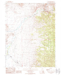
1988 Map of Long Dry Canyon
USGS Topo · Published 1989About this map
The West Walker River carves through this high-desert borderland, serving as a lifeline for the agricultural and ranching tracts of Antelope Valley. The map documents a complex web of water management infrastructure, including the Hoye Canyon Canal and the Gaging Sta near Hoye Bridge, which speak to the area's dependence on river flow. To the east, the steep, ridged terrain of the Gray Hills and the Toiyabe National Forest provides a sharp contrast to the flat basin floor where Little Alkali Lake and Alkali Flat dominate the landscape.
Find a feature on this map
19 named features on this map. Tap any name to fly to it.
Don’t see what you’re looking for? This feature index may not catch every label — zoom into the map to look around manually.
Map Details
Editions of this 1988 Long Dry Canyon Map
This is the sole edition of this map. No revisions or reprints were ever made.
Other maps of this area

1889 · Markleeville
USGS Topo · 1:125,000

1891 · Markleeville
USGS Topo · 1:125,000

1891 · Wellington
USGS Topo · 1:125,000

1893 · Markleeville
USGS Topo · 1:125,000

1893 · Wellington
USGS Topo · 1:125,000

1948 · Walker Lake
USGS Topo · 1:250,000

1956 · Desert Creek Peak
USGS Topo · 1:62,500

1956 · Topaz Lake
USGS Topo · 1:62,500

1957 · Walker Lake
USGS Topo · 1:250,000

1957 · Wellington
USGS Topo · 1:62,500