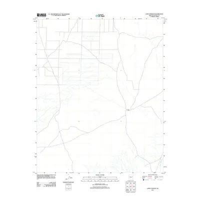
2011 Map of Long H Ranch
USGS Topo · Published 2011About this map
Long H Ranch sits at the heart of this high-desert landscape in Apache County, representing the persistent ranching operations that define this corner of the Arizona-New Mexico borderlands. This 2011 survey reveals an environment shaped by seasonal water flow, most notably through Hardscrabble Wash, which cuts across the southeastern corner of the quadrangle. The map captures a transition period in rural infrastructure, showing a minimal network of local roads and unimproved paths that connect the ranch to the wider region. The sparse distribution of named features emphasizes the open, agricultural character of the territory, providing a clear record of land use and water drainage patterns essential for local history researchers and land managers studying the contemporary geography of the area.
Find a feature on this map
2 named features on this map. Tap any name to fly to it.
Don’t see what you’re looking for? This feature index may not catch every label — zoom into the map to look around manually.
Map Details
Editions of this 2011 Long H Ranch Map
This is the sole edition of this map. No revisions or reprints were ever made.
Other maps of this area

1886 · St Johns
USGS Topo · 1:250,000

1892 · St Johns
USGS Topo · 1:250,000

1954 · Saint Johns
USGS Topo · 1:250,000

1955 · Adamana 4 NE
USGS Topo · 1:24,000

1955 · Wolford Springs 3 NW
USGS Topo · 1:24,000

1955 · Hunt
USGS Topo · 1:62,500

1957 · Saint Johns
USGS Topo · 1:250,000

1958 · Saint Johns
USGS Topo · 1:250,000

1962 · Saint Johns
USGS Topo · 1:250,000
1974 · Ninemile Seep
USGS Topo · 1:24,000