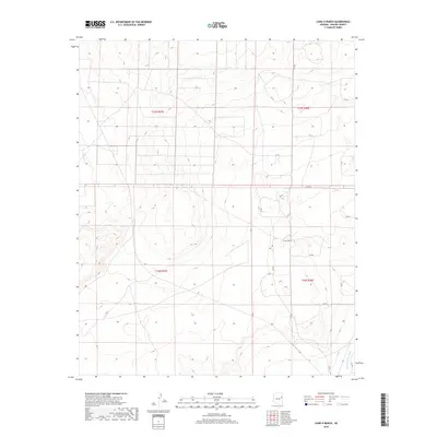
2018 Map of Long H Ranch
USGS Topo · Published 2018About this map
Long H Ranch sits at the heart of this high-plateau landscape in Apache County, where the topography is defined by the ephemeral drainage of Hardscrabble Wash. The map reveals a sparse network of ranching roads and tracks, such as Dc Dr, n7117, and n7118, which connect isolated wells and stock-watering points across the open range. This 2018 survey captures the region's enduring character as an active cattle-ranching territory, structured by the Public Land Survey System sections of t17n r27e and t16n r28e. The absence of dense settlement highlights the expansive nature of these high-desert holdings, where water sources and unimproved roads are the primary human signatures on the land.
Find a feature on this map
23 named features on this map. Tap any name to fly to it.
Don’t see what you’re looking for? This feature index may not catch every label — zoom into the map to look around manually.
Map Details
Editions of this 2018 Long H Ranch Map
This is the sole edition of this map. No revisions or reprints were ever made.
Other maps of this area

1886 · St Johns
USGS Topo · 1:250,000

1892 · St Johns
USGS Topo · 1:250,000

1954 · Saint Johns
USGS Topo · 1:250,000

1955 · Adamana 4 NE
USGS Topo · 1:24,000

1955 · Wolford Springs 3 NW
USGS Topo · 1:24,000

1955 · Hunt
USGS Topo · 1:62,500

1957 · Saint Johns
USGS Topo · 1:250,000

1958 · Saint Johns
USGS Topo · 1:250,000

1962 · Saint Johns
USGS Topo · 1:250,000
1974 · Ninemile Seep
USGS Topo · 1:24,000