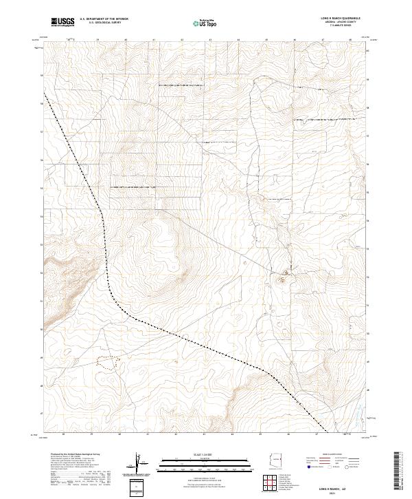
2021 Map of Long H Ranch
USGS Topo · Published 2021About this map
Long H Ranch serves as the primary focal point of this high-desert landscape in Apache County, captured in 2021. The terrain is defined by a systematic network of Bureau of Land Management routes, including n7117 and n7104, which provide access across the township and range divisions of t16n r27e and t17n r28e. The topography is shaped by the drainage patterns of Hardscrabble Wash, which winds through the southern portion of the quadrangle. This survey illustrates the modern ranching and land management infrastructure of northern Arizona, showing the precise intersection of cattle-country tradition with contemporary road naming conventions like Dc Dr. The sparse distribution of named features highlights the open, working nature of the land, where named wells and springs noted in the margin serve as critical nodes for local activity.
Find a feature on this map
21 named features on this map. Tap any name to fly to it.
Don’t see what you’re looking for? This feature index may not catch every label — zoom into the map to look around manually.
Map Details
Editions of this 2021 Long H Ranch Map
This is the sole edition of this map. No revisions or reprints were ever made.
Other maps of this area

1886 · St Johns
USGS Topo · 1:250,000

1892 · St Johns
USGS Topo · 1:250,000

1954 · Saint Johns
USGS Topo · 1:250,000

1955 · Adamana 4 NE
USGS Topo · 1:24,000

1955 · Wolford Springs 3 NW
USGS Topo · 1:24,000

1955 · Hunt
USGS Topo · 1:62,500

1957 · Saint Johns
USGS Topo · 1:250,000

1958 · Saint Johns
USGS Topo · 1:250,000

1962 · Saint Johns
USGS Topo · 1:250,000
1974 · Ninemile Seep
USGS Topo · 1:24,000