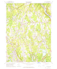
1964 Map of Long Hill
USGS Topo · Published 1967About this map
East Village and Monroe anchor the northern reaches of this Fairfield County landscape during a period of mid-century suburban transition. The topography is defined by significant water management and recreation sites, including the large Trap Falls Reservoir, Isinglass Reservoir, and Canoe Brook Lake. These bodies of water, along with the Housatonic River bordering the northeast, shaped the local economy and settlement patterns long before modern infrastructure dominated.
Find a feature on this map
82 named features on this map. Tap any name to fly to it.
Don’t see what you’re looking for? This feature index may not catch every label — zoom into the map to look around manually.
Map Details
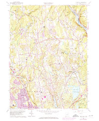
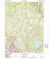
Editions of this 1964 Long Hill Map
3 editions found
Other maps of this area

1889 · Derby
USGS Topo · 1:62,500

1891 · Bridgeport
USGS Topo · 1:62,500

1891 · Derby
USGS Topo · 1:62,500

1892 · Danbury
USGS Topo · 1:62,500

1892 · Norwalk
USGS Topo · 1:62,500

1893 · Bridgeport
USGS Topo · 1:62,500

1893 · Norwalk
USGS Topo · 1:62,500

1893 · Derby
USGS Topo · 1:62,500

1915 · Danbury
USGS Topo · 1:62,500

1920 · Bridgeport
USGS Topo · 1:62,500