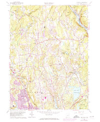
1964 Map of Long Hill
USGS Topo · Published 1974About this map
Trap Falls Reservoir and Isinglass Reservoir anchor the eastern landscape of Fairfield County in this mid-century portrait of suburbanization and utility infrastructure. The map documents the growth of Long Hill and Huntington, where expanding residential footprints meet the older agricultural and industrial layers of the Connecticut countryside. Along the western edge, the Penn Central railroad corridors and the Merritt Parkway facilitate regional movement, while specialized landmarks like Tungsten Mine Park hint at the area's mineral history. Educational and religious institutions are prominent, including Masuk High Sch and St Josephs High Sch, reflecting the community's post-war development. From the heights of Booth Hill to the valley of the Housatonic River, the map captures a period of transition as traditional landmarks like Walker Farm and Cutlers Farm are surrounded by modern civil engineering and burgeoning neighborhoods.
Find a feature on this map
61 named features on this map. Tap any name to fly to it.
Don’t see what you’re looking for? This feature index may not catch every label — zoom into the map to look around manually.
Map Details
Editions of this 1964 Long Hill Map
3 editions found
Other maps of this area

1889 · Derby
USGS Topo · 1:62,500

1891 · Bridgeport
USGS Topo · 1:62,500

1891 · Derby
USGS Topo · 1:62,500

1892 · Danbury
USGS Topo · 1:62,500

1892 · Norwalk
USGS Topo · 1:62,500

1893 · Bridgeport
USGS Topo · 1:62,500

1893 · Norwalk
USGS Topo · 1:62,500

1893 · Derby
USGS Topo · 1:62,500

1915 · Danbury
USGS Topo · 1:62,500

1920 · Bridgeport
USGS Topo · 1:62,500