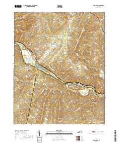
2019 Map of Long Island
USGS Topo · Published 2019About this map
The Roanoke River serves as the primary geographical axis for this region, carving a path where Campbell, Pittsylvania, and Halifax counties converge. This landscape is defined by its water systems and the settlements that grew alongside them, from the riverside community of Long Island to the higher elevations of Dry Mtn. The topography is marked by several large river features, including Goat Island and the Hale Islands, which sit within the main river channel.
Find a feature on this map
66 named features on this map. Tap any name to fly to it.
Don’t see what you’re looking for? This feature index may not catch every label — zoom into the map to look around manually.
Map Details
Editions of this 2019 Long Island Map
This is the sole edition of this map. No revisions or reprints were ever made.
Other maps of this area

1892 · Lynchburg
USGS Topo · 1:125,000

1892 · Appomattox
USGS Topo · 1:125,000

1947 · Roanoke
USGS Topo · 1:250,000

1953 · Greensboro
USGS Topo · 1:250,000

1954 · Greensboro
USGS Topo · 1:250,000

1954 · Halifax
USGS Topo · 1:62,500

1954 · Riceville
USGS Topo · 1:62,500

1956 · Brookneal
USGS Topo · 1:62,500

1956 · Gladys
USGS Topo · 1:62,500

1959 · Roanoke
USGS Topo · 1:250,000