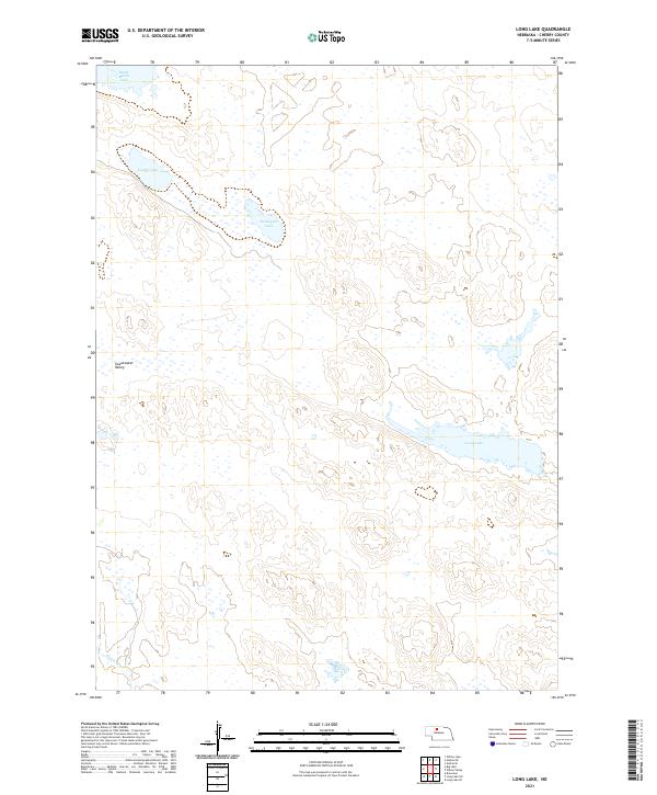
2021 Map of Long Lake
USGS Topo · Published 2021About this map
Long Lake and several smaller basins define the hydrography of this Cherry County landscape, as documented by the U.S. Geological Survey in 2021. The region is characterized by a series of significant water bodies including South Marsh Lake, Center Lake, and Twentyone Lake, which reflect the hydrology of the Nebraska Sandhills. These lakes are connected by a network of drainage features such as Goose Cr, winding through the low-lying terrain. The map identifies the Sweetwater Valley, a distinct geographical feature that orientations the surrounding wetlands and marshes. This survey provides a precise modern look at the wetland ecosystems and topography of the Sandhills, essential for understanding the environmental shifts in this unique grassland region.
Find a feature on this map
10 named features on this map. Tap any name to fly to it.
Don’t see what you’re looking for? This feature index may not catch every label — zoom into the map to look around manually.
Map Details
Editions of this 2021 Long Lake Map
This is the sole edition of this map. No revisions or reprints were ever made.
Other maps of this area

1949 · Long Lake
USGS Topo · 1:62,500

1950 · Simeon
USGS Topo · 1:62,500

1950 · Arabia
USGS Topo · 1:62,500

1951 · Long Lake
USGS Topo · 1:62,500

1951 · Brownlee
USGS Topo · 1:62,500

1957 · Valentine
USGS Topo · 1:250,000

1959 · Valentine
USGS Topo · 1:250,000

1985 · Long Lake
USGS Topo · 1:24,000

1985 · Wilson Valley
USGS Topo · 1:24,000
1985 · Arabia SE
USGS Topo · 1:24,000