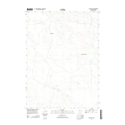
2014 Map of Long Lake SE
USGS Topo · Published 2014About this map
Piercy Place and Hartgraves Place anchor this 2014 topographic survey of Cherry County, Nebraska, representing the distinct homestead and ranching pattern of the Sandhills. The landscape is defined by the winding course of Goose Cr in the south, which cuts through a complex network of dunes and depressions. The presence of these named ranch sites suggests a continuation of the region's historical land use, where large-scale operations are often identified by their founding families. While the area is sparsely populated, the map tracks several local roads and the topographical nuances of the terrain that surround these specific locales, offering a detailed look at the rural spatial arrangement of the Nebraska interior during the early twenty-first century.
Find a feature on this map
3 named features on this map. Tap any name to fly to it.
Don’t see what you’re looking for? This feature index may not catch every label — zoom into the map to look around manually.
Map Details
Editions of this 2014 Long Lake SE Map
This is the sole edition of this map. No revisions or reprints were ever made.
Other maps of this area

1949 · Purdum
USGS Topo · 1:62,500

1949 · Koshopah
USGS Topo · 1:62,500

1949 · Long Lake
USGS Topo · 1:62,500

1951 · Long Lake
USGS Topo · 1:62,500

1951 · Purdum
USGS Topo · 1:62,500

1951 · Moon Lake
USGS Topo · 1:62,500

1951 · Koshopah
USGS Topo · 1:62,500

1957 · Valentine
USGS Topo · 1:250,000

1959 · Valentine
USGS Topo · 1:250,000

1985 · Long Lake
USGS Topo · 1:24,000