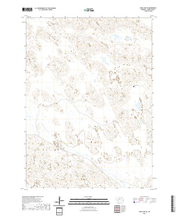
2021 Map of Long Lake SE
USGS Topo · Published 2021About this map
Goose Creek winds through the sandhills of south-central Cherry County in this recent survey. The landscape is defined by the unique hydrology of the Nebraska Sandhills, where numerous small, unnamed wetlands and ponds dot the interdunal valleys between the ridges. The sparse settlement pattern is typical of this ranching region, anchored by the lone historical marker of Hartgrave Cemetery on the eastern edge of the quadrangle. The map details the complex Public Land Survey System boundaries, including the intersection of t27n r26w and t27n r25w, providing a precise look at the township and range divisions that have shaped land ownership in the Nebraska interior for generations.
Find a feature on this map
8 named features on this map. Tap any name to fly to it.
Don’t see what you’re looking for? This feature index may not catch every label — zoom into the map to look around manually.
Map Details
Editions of this 2021 Long Lake SE Map
This is the sole edition of this map. No revisions or reprints were ever made.
Other maps of this area

1949 · Purdum
USGS Topo · 1:62,500

1949 · Koshopah
USGS Topo · 1:62,500

1949 · Long Lake
USGS Topo · 1:62,500

1951 · Long Lake
USGS Topo · 1:62,500

1951 · Purdum
USGS Topo · 1:62,500

1951 · Moon Lake
USGS Topo · 1:62,500

1951 · Koshopah
USGS Topo · 1:62,500

1957 · Valentine
USGS Topo · 1:250,000

1959 · Valentine
USGS Topo · 1:250,000

1985 · Long Lake
USGS Topo · 1:24,000