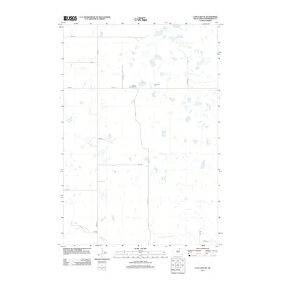
2012 Map of Long Lake SE
USGS Topo · Published 2012About this map
Hoffnungs Gemeinde Cem and the nearby Hoffnungs Cem serve as key local landmarks in this rural landscape of McPherson County. The terrain is defined by a dense network of prairie potholes and small seasonal basins typical of the region, creating a distinctive hydrological pattern across the northern section of the map. In the southern reach, the landscape begins to drain toward the meandering path of Foot Creek. This 2012 survey illustrates the organized grid of county roads, such as Plum Rd and Oak Rd, which segment the agricultural lands. The placement of these cemeteries amidst the sections provides a valuable reference point for genealogists tracing early German-Russian settlement patterns in this part of South Dakota, where the placement of small community burial grounds often reflects the legacy of original homesteading families.
Find a feature on this map
18 named features on this map. Tap any name to fly to it.
Don’t see what you’re looking for? This feature index may not catch every label — zoom into the map to look around manually.
Map Details
Editions of this 2012 Long Lake SE Map
This is the sole edition of this map. No revisions or reprints were ever made.
Other maps of this area

1899 · Ellendale
USGS Topo · 1:125,000

1954 · Aberdeen
USGS Topo · 1:250,000

1956 · Aberdeen
USGS Topo · 1:250,000

1968 · Long Lake
USGS Topo · 1:24,000

1968 · Long Lake SE
USGS Topo · 1:24,000

1968 · Long Lake NW
USGS Topo · 1:24,000

1968 · Long Lake NE
USGS Topo · 1:24,000
1968 · Forbes NW
USGS Topo · 1:24,000

1968 · Forbes SW
USGS Topo · 1:24,000

1970 · Leola
USGS Topo · 1:24,000