
1968 Map of Long Lake
USGS Topo · Published 1970About this map
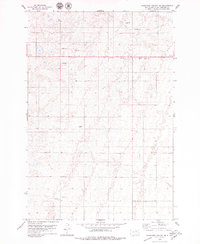
Long Lake (Longlake PO) serves as the primary hub for this McPherson County landscape in the late 1960s, a region defined by its scattered wetlands and prairie topography. The map documents a community deeply rooted in its local geography, evidenced by several rural burial sites such as Emmanuel Cem, Salem Cem, and Arena Valley Cem. These points of interest offer valuable data for genealogists tracing family names within the northern plains. A prominent Old Railroad Grade cuts across the northeastern sections, marking the path of former transportation infrastructure that once connected these remote townships to larger markets. The presence of multiple Gravel Pits and a Sewage Disposal Pond near the main settlement highlights the mid-century municipal and industrial utility of the area during this 1968 field survey.
Find a feature on this map
7 named features on this map. Tap any name to fly to it.
Don’t see what you’re looking for? This feature index may not catch every label — zoom into the map to look around manually.
Map Details
Editions of this 1968 Long Lake Map
This is the sole edition of this map. No revisions or reprints were ever made.
Other maps of this area

1954 · Aberdeen
USGS Topo · 1:250,000

1956 · Aberdeen
USGS Topo · 1:250,000

1968 · Long Lake SE
USGS Topo · 1:24,000

1968 · Long Lake NW
USGS Topo · 1:24,000

1968 · Long Lake NE
USGS Topo · 1:24,000

1978 · Hosmer NE
USGS Topo · 1:24,000
1978 · Plainview Colony NE
USGS Topo · 1:24,000

1978 · Schumacher Lake
USGS Topo · 1:24,000

1978 · Plainview Colony NW
USGS Topo · 1:24,000

1978 · Schumacher Lake NE
USGS Topo · 1:24,000