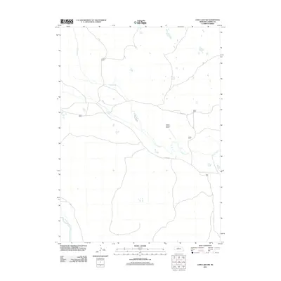
2011 Map of Long Lake SW
USGS Topo · Published 2011About this map
Goose Creek defines the hydrography of this Nebraska Sandhills region, meandering southeast toward its eventual junction with the North Loup River in the southwestern corner of the quadrangle. The 2011 landscape remains characterized by large-scale ranching operations, including Hanna Ranch, N Hanna Ranch, and Weber Ranch. These family-named landmarks reflect the enduring agricultural patterns of Cherry County, where property lines and isolated ranch houses provide the primary structural markers across the terrain.
Find a feature on this map
9 named features on this map. Tap any name to fly to it.
Don’t see what you’re looking for? This feature index may not catch every label — zoom into the map to look around manually.
Map Details
Editions of this 2011 Long Lake SW Map
This is the sole edition of this map. No revisions or reprints were ever made.
Other maps of this area

1948 · Seneca 4
USGS Topo · 1:62,500

1949 · Seneca 4
USGS Topo · 1:62,500

1949 · Purdum
USGS Topo · 1:62,500

1949 · Long Lake
USGS Topo · 1:62,500

1951 · Long Lake
USGS Topo · 1:62,500

1951 · Purdum
USGS Topo · 1:62,500

1951 · Brownlee
USGS Topo · 1:62,500

1957 · Valentine
USGS Topo · 1:250,000

1959 · Valentine
USGS Topo · 1:250,000

1985 · Long Lake
USGS Topo · 1:24,000