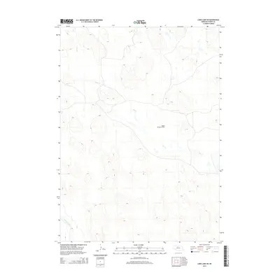
2014 Map of Long Lake SW
USGS Topo · Published 2014About this map
North Loup River winds through the southwestern corner of this Cherry County landscape, a region defined by the intricate drainage patterns of the Nebraska Sandhills. The area is dominated by the meandering course of Goose Cr, which spans the central and eastern portions of the quadrangle. This 2014 survey reveals a sparse human footprint typical of the western prairie, where wide-open ranch land is punctuated only by occasional aviation infrastructure like the Higgins Brothers Airport. The map's detailed contouring illustrates the complex topography of the hills and blowouts that characterize this portion of the state, providing a clear record of the hydrologic relationship between the local creeks and the river system.
Find a feature on this map
3 named features on this map. Tap any name to fly to it.
Don’t see what you’re looking for? This feature index may not catch every label — zoom into the map to look around manually.
Map Details
Editions of this 2014 Long Lake SW Map
This is the sole edition of this map. No revisions or reprints were ever made.
Other maps of this area

1948 · Seneca 4
USGS Topo · 1:62,500

1949 · Seneca 4
USGS Topo · 1:62,500

1949 · Purdum
USGS Topo · 1:62,500

1949 · Long Lake
USGS Topo · 1:62,500

1951 · Long Lake
USGS Topo · 1:62,500

1951 · Purdum
USGS Topo · 1:62,500

1951 · Brownlee
USGS Topo · 1:62,500

1957 · Valentine
USGS Topo · 1:250,000

1959 · Valentine
USGS Topo · 1:250,000

1985 · Long Lake
USGS Topo · 1:24,000