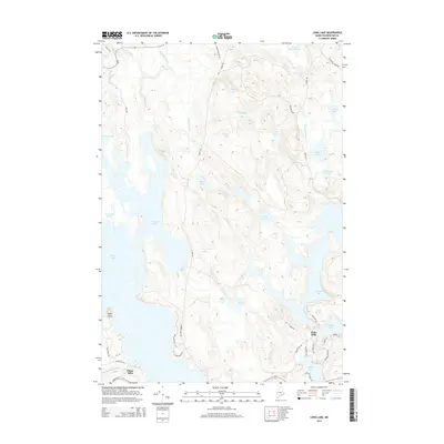
2014 Map of Long Lake
USGS Topo · Published 2014About this map
Gardner Lake and Long Lake dominate this glaciated landscape in Washington County, where a network of interconnected waterways defines the region's geography. The small settlements of Halls Mills and Chase Mills stand as historical anchors near the southern drainage of these basins. The terrain is a complex of wetlands and ridges, featuring landmarks like High Head and Ell Pt, with numerous secondary water bodies such as Orange Lake, Sunken Lake, and Indian Lake illustrating the water-rich environment.
Find a feature on this map
53 named features on this map. Tap any name to fly to it.
Don’t see what you’re looking for? This feature index may not catch every label — zoom into the map to look around manually.
Map Details
Editions of this 2014 Long Lake Map
This is the sole edition of this map. No revisions or reprints were ever made.
Other maps of this area

1907 · Eastport
USGS Topo · 1:48,000

1908 · Eastport
USGS Topo · 1:62,500

1917 · Cutler
USGS Topo · 1:62,500

1918 · Machias
USGS Topo · 1:62,500

1918 · Cutler
USGS Topo · 1:62,500

1941 · Machias
USGS Topo · 1:62,500

1941 · Gardner Lake
USGS Topo · 1:62,500

1943 · Gardner Lake
USGS Topo · 1:62,500

1943 · Eastport
USGS Topo · 1:62,500

1945 · Eastport
USGS Topo · 1:62,500