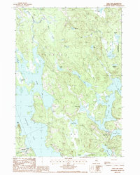
1987 Map of Long Lake
USGS Topo · Published 1988About this map
The East Machias River winds through this coastal Maine landscape, connecting a complex network of glacial lakes and wetlands in the late 1980s. Small riverside settlements like Chase Mills and Halls Mills define the local human geography, situated among larger water bodies including Gardner Lake and Second Lake. The presence of the Moosehorn National Wildlife Refuge and Hobart Bog highlights the protected conservation areas that dominate the eastern portion of the sheet.
Find a feature on this map
37 named features on this map. Tap any name to fly to it.
Don’t see what you’re looking for? This feature index may not catch every label — zoom into the map to look around manually.
Map Details
Editions of this 1987 Long Lake Map
This is the sole edition of this map. No revisions or reprints were ever made.
Other maps of this area

1907 · Eastport
USGS Topo · 1:48,000

1908 · Eastport
USGS Topo · 1:62,500

1917 · Cutler
USGS Topo · 1:62,500

1918 · Machias
USGS Topo · 1:62,500

1918 · Cutler
USGS Topo · 1:62,500

1941 · Machias
USGS Topo · 1:62,500

1941 · Gardner Lake
USGS Topo · 1:62,500

1943 · Gardner Lake
USGS Topo · 1:62,500

1943 · Eastport
USGS Topo · 1:62,500

1945 · Eastport
USGS Topo · 1:62,500