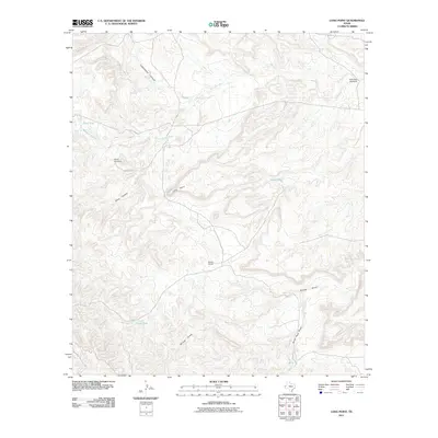
2011 Map of Long Point
USGS Topo · Published 2011About this map
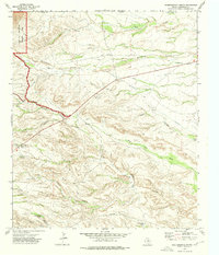
South Camp sits as a lone human outpost in this high-desert landscape of Culberson County, where the management of water is the primary concern for any inhabitant. The Delaware River cuts through the northern portion of the terrain, while life further south depends on a network of man-made improvements like the Force Windmill and Rock Tank Windmill. These features, along with strategically placed water catchments such as Deep Tank and End Tank, illustrate the ranching infrastructure necessary to survive in this arid environment. The map is defined by its dramatic relief, highlighted by the namesake Long Point and deep drainage systems like Cottonwood Canyon and Piñon Canyon. These geographical landmarks provide essential orientation points in a region where natural springs are replaced by engineered tanks like Little Piñon Tank, serving as critical hubs for local livestock and wildlife in the early 21st century.
Find a feature on this map
12 named features on this map. Tap any name to fly to it.
Don’t see what you’re looking for? This feature index may not catch every label — zoom into the map to look around manually.
Map Details
Editions of this 2011 Long Point Map
This is the sole edition of this map. No revisions or reprints were ever made.
Other maps of this area

1933 · Guadalupe Peak
USGS Topo · 1:48,000

1940 · Guadalupe Peak
USGS Topo · 1:62,500

1954 · Van Horn
USGS Topo · 1:250,000

1958 · Van Horn
USGS Topo · 1:250,000

1973 · Chico Draw East
USGS Topo · 1:24,000

1973 · Cow Mountain
USGS Topo · 1:24,000
1973 · Long Point
USGS Topo · 1:24,000
1973 · Six Bar Ranch
USGS Topo · 1:24,000
1973 · Chico Draw West
USGS Topo · 1:24,000
1973 · Independence Spring
USGS Topo · 1:24,000