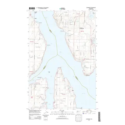
2014 Map of Longbranch
USGS Topo · Published 2014About this map
Harstine Island and the jagged southern tips of the Great Peninsula define this maritime landscape where the waters of Puget Sound meet Dana Passage and Henderson Inlet. The settlement of Longbranch serves as a focal point on the eastern peninsula, situated near the protected waters of Filucy Bay and Taylor Bay. Further west, across the Case Inlet, the community of Ballow and the narrow strip of McMicken Island mark the shoreline of Harstine Island. Local transportation is anchored by the Key Peninsula Hwy S and the small Howell Airport, reflecting a region deeply tied to its coastal geography. Notable points such as Fudge Point, Wilson Point, and Johnson Point delineate the complex network of coves and bights, including Whiteman Cove and Big Fishtrap, that have historically shaped the navigation and development of this shoreline.
Find a feature on this map
111 named features on this map. Tap any name to fly to it.
Don’t see what you’re looking for? This feature index may not catch every label — zoom into the map to look around manually.
Map Details
Editions of this 2014 Longbranch Map
This is the sole edition of this map. No revisions or reprints were ever made.
Other maps of this area

1937 · Olympia
USGS Topo · 1:62,500

1938 · Allyn
USGS Topo · 1:62,500

1940 · Anderson Island
USGS Topo · 1:62,500

1942 · Gig Harbor
USGS Topo · 1:62,500

1943 · Gig Harbor
USGS Topo · 1:62,500

1948 · Anderson Island
USGS Topo · 1:62,500

1948 · Nisqually
USGS Topo · 1:24,000

1948 · Anderson Island
USGS Topo · 1:24,000

1949 · Olympia
USGS Topo · 1:62,500

1953 · Sylvan
USGS Topo · 1:24,000