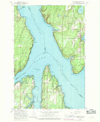
1959 Map of Longbranch
USGS Topo · Published 1969About this map
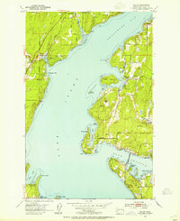
Hartstene Island and the Key Peninsula dominate this maritime landscape where the waters of Case Inlet and Nisqually Reach converge. Surveyed in the late 1950s with late 1960s revisions, this map captures the intricate shoreline of South Puget Sound, defined by protected waters like Filucy Bay and Taylor Bay. Small coastal communities such as Longbranch and Ballow are connected by rural routes including Longbranch Road and Whiteman Road. The topography reveals a complex network of freshwater lakes, such as Bay Lake and Palmer Lake, situated just inland from the saltwater coves. Noteworthy landmarks like the southern tip of the peninsula at Devils Head and the isolated McMicken Island illustrate the navigational challenges and natural sheltered harbors that shaped the development of this Pierce County waterfront.
Find a feature on this map
42 named features on this map. Tap any name to fly to it.
Don’t see what you’re looking for? This feature index may not catch every label — zoom into the map to look around manually.
Map Details
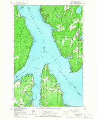
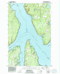
Editions of this 1959 Longbranch Map
3 editions found
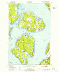
Other maps of this area

1937 · Olympia
USGS Topo · 1:62,500

1938 · Allyn
USGS Topo · 1:62,500

1940 · Anderson Island
USGS Topo · 1:62,500

1942 · Gig Harbor
USGS Topo · 1:62,500

1943 · Gig Harbor
USGS Topo · 1:62,500

1948 · Anderson Island
USGS Topo · 1:62,500

1948 · Nisqually
USGS Topo · 1:24,000
1948 · Anderson Island
USGS Topo · 1:24,000

1949 · Olympia
USGS Topo · 1:62,500
1953 · Sylvan
USGS Topo · 1:24,000