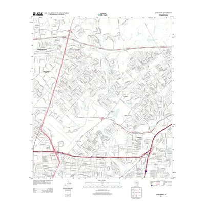
2013 Map of Longhorn
USGS Topo · Published 2013About this map
San Antonio International Airport dominates the southwestern portion of this landscape, marking the transition from the city's suburban expansion to the developed residential communities of Hollywood Park, Windcrest, and Hill Country Village. The area is defined by a dense network of major transportation arteries, including the intersection of Interstate 35, Us 281, and NE Loop 410, which facilitate the rapid suburban growth seen in the early 21st century. Interspersed among these modern subdivisions are numerous small burial grounds that preserve the area's local history, such as Wetmore Cem, Classen Cem, and Schulmeier Cem. Several tributaries, including Salado Cr and Beitel Cr, flow through the terrain, providing natural breaks in the urban grid. The presence of smaller landing strips like Yates Airport and Twin-Oaks Airport highlights the region's long-standing aviation character beyond the primary international hub.
Find a feature on this map
34 named features on this map. Tap any name to fly to it.
Don’t see what you’re looking for? This feature index may not catch every label — zoom into the map to look around manually.
Map Details
Editions of this 2013 Longhorn Map
This is the sole edition of this map. No revisions or reprints were ever made.
Other maps of this area

1953 · Otis Ridge
USGS Topo · 1:24,000

1953 · Schertz
USGS Topo · 1:24,000

1953 · San Antonio West
USGS Topo · 1:24,000

1953 · Bulverde
USGS Topo · 1:24,000

1953 · San Antonio East
USGS Topo · 1:24,000

1953 · Bat Cave
USGS Topo · 1:24,000

1953 · Longhorn
USGS Topo · 1:24,000

1953 · Castle Hills
USGS Topo · 1:24,000

1953 · Martinez
USGS Topo · 1:24,000

1954 · San Antonio
USGS Topo · 1:250,000