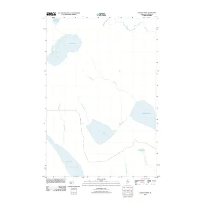
2011 Map of Longley Pond
USGS Topo · Published 2011About this map
Chesuncook Lake and its northern neighbor Black Pond dominate the southwestern corner of this remote Maine landscape, reflecting the timber-driven geography of Piscataquis County in the early 21st century. The map centers on the drainage of Longley Pond and Longley Stream, which connect a series of interconnected water bodies including Umbazooksus Lake and Shallow Lake. Unlike many historical maps of this region that focus on permanent settlements, this survey highlights the infrastructure of the logging industry, specifically the International Paper Rd and Longley Stream Rd. These private industrial routes are the primary arteries through the dense forests, following the natural corridors established by Smith Brook and Ellis Brook to the north. The presence of Little Longley Pond and its associated streams illustrates the intricate hydrology that has historically supported seasonal camps and woods operations in this portion of the Maine North Woods.
Find a feature on this map
16 named features on this map. Tap any name to fly to it.
Don’t see what you’re looking for? This feature index may not catch every label — zoom into the map to look around manually.
Map Details
Editions of this 2011 Longley Pond Map
This is the sole edition of this map. No revisions or reprints were ever made.
Other maps of this area

1954 · Chesuncook
USGS Topo · 1:62,500

1954 · Caucomgomoc Lake
USGS Topo · 1:62,500

1954 · Churchill Lake
USGS Topo · 1:62,500

1954 · Allagash Lake
USGS Topo · 1:62,500

1954 · Presque Isle
USGS Topo · 1:250,000

1958 · Presque Isle
USGS Topo · 1:250,000

1958 · Chesuncook
USGS Topo · 1:62,500

1958 · Caucomgomoc Lake
USGS Topo · 1:62,500

1960 · Presque Isle
USGS Topo · 1:250,000

1961 · Allagash Lake
USGS Topo · 1:62,500