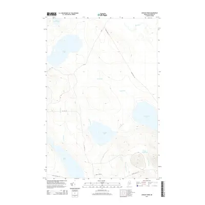
2014 Map of Longley Pond
USGS Topo · Published 2014About this map
Longley Pond and the expansive waters of Umbazooksus Lake anchor this 2014 study of the Maine woods in Piscataquis County. This interior landscape is defined by an intricate network of drainage and timber access, where Longley Stream and Smith Brook wind through the hills to feed the larger basins. The presence of logging infrastructure is evident through the naming of routes like Grande Marche Rd and Guy Allen Rd, which cut through the drainage basins of Black Brook and Ellis Brook. To the northwest, Shallow Lake and Little Shallow Lake occupy the lower elevations, while the southern reaches feature the smaller Black Pond and Little Longley Pond. The map illustrates a remote timberland environment where the primary human footprint is represented by seasonal roads and a complex system of brooks that have long supported the regional forestry economy.
Find a feature on this map
18 named features on this map. Tap any name to fly to it.
Don’t see what you’re looking for? This feature index may not catch every label — zoom into the map to look around manually.
Map Details
Editions of this 2014 Longley Pond Map
This is the sole edition of this map. No revisions or reprints were ever made.
Other maps of this area

1954 · Chesuncook
USGS Topo · 1:62,500

1954 · Caucomgomoc Lake
USGS Topo · 1:62,500

1954 · Churchill Lake
USGS Topo · 1:62,500

1954 · Allagash Lake
USGS Topo · 1:62,500

1954 · Presque Isle
USGS Topo · 1:250,000

1958 · Presque Isle
USGS Topo · 1:250,000

1958 · Chesuncook
USGS Topo · 1:62,500

1958 · Caucomgomoc Lake
USGS Topo · 1:62,500

1960 · Presque Isle
USGS Topo · 1:250,000

1961 · Allagash Lake
USGS Topo · 1:62,500