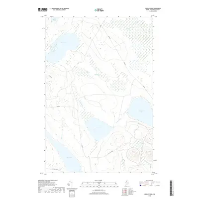
2018 Map of Longley Pond
USGS Topo · Published 2018About this map
Umbazooksus Lake and the interconnected wetlands of the North Maine Woods define this remote section of Piscataquis County. This 2018 survey documents a landscape dominated by timber management infrastructure and glacial hydrology. The drainage patterns are intricate, with Longley Stream connecting Longley Pond to larger water bodies, while extensive peatlands like Smith Brook Bog and Ellis Bog flank the waterways. Transportation in this interior region is strictly utilitarian, represented by a network of logging corridors such as Pingree Rd and seasonal routes like Black Pond Winter Rd. The map illustrates the contemporary balance between industrial forest access and the preservation of large-scale water features including Shallow Lake and the smaller Little Longley Pond, providing an essential reference for understanding modern land use in the Maine wilderness.
Find a feature on this map
20 named features on this map. Tap any name to fly to it.
Don’t see what you’re looking for? This feature index may not catch every label — zoom into the map to look around manually.
Map Details
Editions of this 2018 Longley Pond Map
This is the sole edition of this map. No revisions or reprints were ever made.
Other maps of this area

1954 · Chesuncook
USGS Topo · 1:62,500

1954 · Caucomgomoc Lake
USGS Topo · 1:62,500

1954 · Churchill Lake
USGS Topo · 1:62,500

1954 · Allagash Lake
USGS Topo · 1:62,500

1954 · Presque Isle
USGS Topo · 1:250,000

1958 · Presque Isle
USGS Topo · 1:250,000

1958 · Chesuncook
USGS Topo · 1:62,500

1958 · Caucomgomoc Lake
USGS Topo · 1:62,500

1960 · Presque Isle
USGS Topo · 1:250,000

1961 · Allagash Lake
USGS Topo · 1:62,500