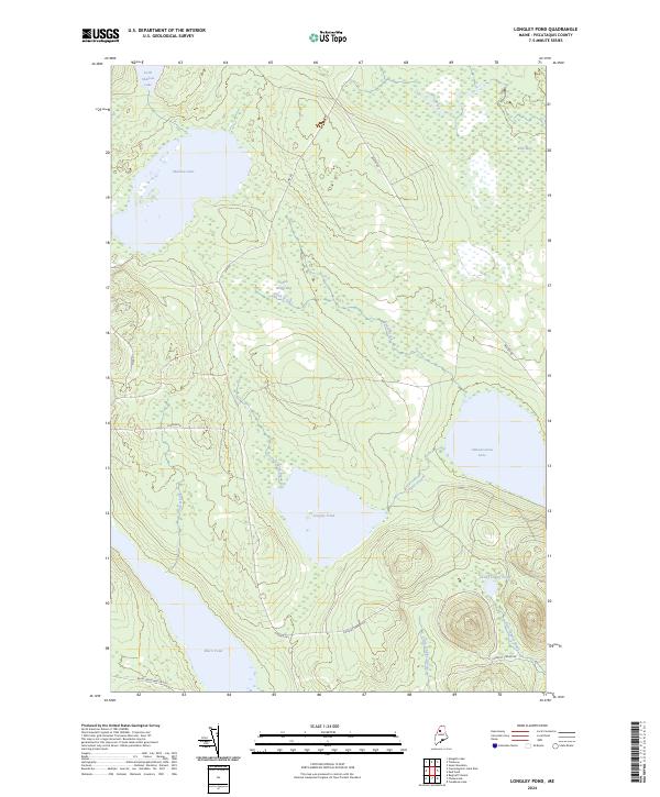
2024 Map of Longley Pond
USGS Topo · Published 2024About this map
Longley Pond sits at the heart of this Piscataquis County landscape, a region defined by an intricate network of waterways and wetlands. The topography is dominated by large basins like Shallow Lake and Umbazooksus Lake, which feed into a complex system of brooks and streams including Smith Brook and Longley Stream. Notable marshlands such as Smith Brook Bog and Ellis Bog illustrate the low-lying, saturated nature of the terrain between the elevated ridges. Navigation through this remote backcountry relies on a sparse network of specialized corridors, including Pingree Rd and NW Rd, alongside seasonal paths like Black Pond Winter Rd. The naming conventions throughout the quadrangle, from Little Longley Pond to Little Shallow Lake, suggest a long-standing local nomenclature tied strictly to the immediate hydrography and the logging history of northern Maine.
Find a feature on this map
20 named features on this map. Tap any name to fly to it.
Don’t see what you’re looking for? This feature index may not catch every label — zoom into the map to look around manually.
Map Details
Editions of this 2024 Longley Pond Map
This is the sole edition of this map. No revisions or reprints were ever made.
Other maps of this area

1954 · Chesuncook
USGS Topo · 1:62,500

1954 · Caucomgomoc Lake
USGS Topo · 1:62,500

1954 · Churchill Lake
USGS Topo · 1:62,500

1954 · Allagash Lake
USGS Topo · 1:62,500

1954 · Presque Isle
USGS Topo · 1:250,000

1958 · Presque Isle
USGS Topo · 1:250,000

1958 · Chesuncook
USGS Topo · 1:62,500

1958 · Caucomgomoc Lake
USGS Topo · 1:62,500

1960 · Presque Isle
USGS Topo · 1:250,000

1961 · Allagash Lake
USGS Topo · 1:62,500