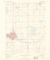
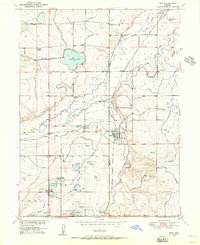
1951 Map of Longmont
USGS Topo · Published 1951About this map
Longmont serves as the focal point of this mid-century landscape, showing a structured grid of residential blocks and public parks like Roosevelt Park and Sunset Park. The surrounding environment is defined by an intricate network of irrigation systems, including the Oligarchy Ditch and Rough and Ready Ditch, which redirect water from St Vrain Creek and Boulder Creek to numerous storage bodies such as Calkins Lake (Union Reservoir). These waterworks illustrate the agricultural engineering required to sustain the communities of Highland, Morey, and Liberty at the edge of the plains.
Find a feature on this map
51 named features on this map. Tap any name to fly to it.
Don’t see what you’re looking for? This feature index may not catch every label — zoom into the map to look around manually.
Map Details
Editions of this 1951 Longmont Map
This is the sole edition of this map. No revisions or reprints were ever made.
Other maps of this area

1902 · Greeley
USGS Topo · 1:125,000

1904 · Niwot
USGS Topo · 1:62,500

1906 · Loveland
USGS Topo · 1:62,500

1908 · Loveland
USGS Topo · 1:62,500
1949 · Gowanda
USGS Topo · 1:24,000
1950 · Frederick
USGS Topo · 1:24,000

1950 · Gowanda
USGS Topo · 1:24,000
1950 · Hygiene
USGS Topo · 1:24,000
1950 · Erie
USGS Topo · 1:24,000
1950 · Niwot
USGS Topo · 1:24,000