
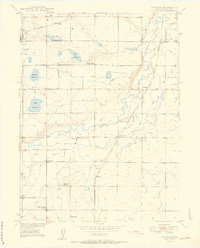
1950 Map of Gowanda
USGS Topo · Published 1950About this map
Agricultural development and water management characterize this Weld County landscape at the midpoint of the twentieth century. The serpentine course of St Vrain Creek bisects the area, feeding an intricate system of irrigation including the Last Chance Ditch and Last Chance Drainage. Small rural communities like Mead and Rinn anchor the western edge, while Gowanda sits along the Union Pacific line near the creek. This survey provides a remarkable record of rural civic life, marking several local education centers such as Stone School and the Pearl Howlett School (Aban'd), alongside the Rinn Valley Grange and Rinn Community Church. The presence of the Great Western railroad and various water storage sites like Lake Marie and Mulligan Reservoir underscores the region's reliance on both rail transport and managed water for its survival.
Find a feature on this map
25 named features on this map. Tap any name to fly to it.
Don’t see what you’re looking for? This feature index may not catch every label — zoom into the map to look around manually.
Map Details
Editions of this 1950 Gowanda Map
2 editions found
Other maps of this area

1902 · Greeley
USGS Topo · 1:125,000

1904 · Niwot
USGS Topo · 1:62,500

1906 · Loveland
USGS Topo · 1:62,500

1908 · Loveland
USGS Topo · 1:62,500

1949 · Gowanda
USGS Topo · 1:24,000

1949 · Fort Lupton
USGS Topo · 1:24,000

1949 · Platteville
USGS Topo · 1:24,000

1950 · Frederick
USGS Topo · 1:24,000

1950 · Platteville
USGS Topo · 1:24,000
1950 · Fort Lupton
USGS Topo · 1:24,000