
1950 Map of Niwot
USGS Topo · Published 1957About this map
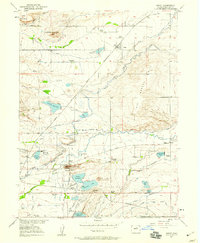
The settlement of Valmont and the surrounding Boulder Valley landscape appear here at the start of the 1950s, defined by a complex web of agricultural irrigation and industrial development. The Colorado White Rock and North Boulder Farmers Ditch and numerous other waterways like the Mc Ginn Ditch illustrate the engineered hydraulic network that supported local farming. Near the Valmont Butte, industrial sites such as the Fluorspar Mill, a Brickyard, and a Power Plant highlight the area's mid-century economic activities.
Find a feature on this map
57 named features on this map. Tap any name to fly to it.
Don’t see what you’re looking for? This feature index may not catch every label — zoom into the map to look around manually.
Map Details
Editions of this 1950 Niwot Map
4 editions found
Other maps of this area

1899 · West Denver
USGS Topo · 1:125,000

1902 · Boulder
USGS Topo · 1:62,500

1904 · Niwot
USGS Topo · 1:62,500

1904 · Boulder
USGS Topo · 1:62,500

1906 · Blackhawk
USGS Topo · 1:62,500

1940 · Lafayette
USGS Topo · 1:31,680

1942 · Eldorado Springs
USGS Topo · 1:24,000

1942 · Louisville
USGS Topo · 1:31,680

1944 · Lafayette
USGS Topo · 1:31,680

1944 · Eldorado Springs
USGS Topo · 1:31,680