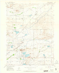
1950 Map of Niwot
USGS Topo · Published 1964About this map
Gun Barrel Hill and the surrounding Boulder County agricultural landscape define this mid-century survey. The area is a complex network of irrigation, featuring numerous water-diversion projects like Farmers Ditch and the Ditch systems that sustain the local farms. At the center of the industrial landscape sits Valmont, where the Fluorite Mill and a nearby Gravel Pit indicate the local extractive economy near Valmont Butte.
Find a feature on this map
45 named features on this map. Tap any name to fly to it.
Don’t see what you’re looking for? This feature index may not catch every label — zoom into the map to look around manually.
Map Details
Editions of this 1950 Niwot Map
4 editions found

Other maps of this area

1899 · West Denver
USGS Topo · 1:125,000

1902 · Boulder
USGS Topo · 1:62,500

1904 · Niwot
USGS Topo · 1:62,500

1904 · Boulder
USGS Topo · 1:62,500

1906 · Blackhawk
USGS Topo · 1:62,500

1940 · Lafayette
USGS Topo · 1:31,680

1942 · Eldorado Springs
USGS Topo · 1:24,000

1942 · Louisville
USGS Topo · 1:31,680

1944 · Lafayette
USGS Topo · 1:31,680

1944 · Eldorado Springs
USGS Topo · 1:31,680