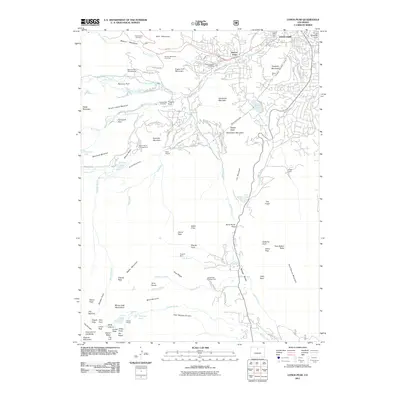
2011 Map of Longs Peak
USGS Topo · Published 2011About this map
Estes Park and its surrounding high-altitude geography are documented in this 2011 survey, showing a landscape defined by significant engineering and natural landmarks. The presence of the Alva B Adams Tunnel, alongside the Rams Horn Tunnel and Prospect Mountain Tunnel, illustrates the complex water and transit infrastructure managed beneath the peaks. Small residential pockets and early settlements like Tuxedo Park and East Portal appear near established local sites such as the Hupp Family Cemetery and the Cleave-Griffith Cemetery. Beyond the village limits, the terrain rises toward Longs Peak and Pagoda Mountain, with specialized features like the Eugenia Mine and the Shelter House near Chasm Lake offering specific points of interest for historical and geological research.
Find a feature on this map
109 named features on this map. Tap any name to fly to it.
Don’t see what you’re looking for? This feature index may not catch every label — zoom into the map to look around manually.
Map Details
Editions of this 2011 Longs Peak Map
This is the sole edition of this map. No revisions or reprints were ever made.
Other maps of this area

1902 · Boulder
USGS Topo · 1:62,500

1904 · Boulder
USGS Topo · 1:62,500

1905 · Mount Olympus
USGS Topo · 1:62,500

1907 · Mount Olympus
USGS Topo · 1:62,500

1915 · Longs Peak
USGS Topo · 1:125,000

1919 · Rocky Mountain National Park
USGS Topo · 1:125,000

1954 · Greeley
USGS Topo · 1:250,000

1957 · Greeley
USGS Topo · 1:250,000

1957 · Mc Henrys Peak
USGS Topo · 1:24,000

1957 · Trail Ridge
USGS Topo · 1:24,000