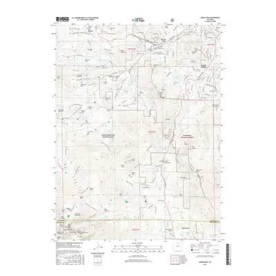
2016 Map of Longs Peak
USGS Topo · Published 2016About this map
Estes Park and the high-altitude reaches of Rocky Mountain National Park are documented here in high detail, showing the complex network of trails and family landmarks that define this region. The landscape is marked by numerous historic burial sites and graves, including the Hupp Family Cem, the Edwin Bradt Grave, and the Cleave-Griffith Cem near Beaver Point. These isolated markers, along with sites like the Tuxedo Park - Ymca Camp, reflect a long history of seasonal habitation and conservation. The map traces significant engineering and recreation features, from the Prospect Mountain Tunnel to the winding Eugenia Mine Trail. To the south, the village of Allenspark sits near the Larimer and Boulder county line, serving as a gateway to the steep terrain of Twin Sisters Mtn and the prominent Estes Cone.
Find a feature on this map
185 named features on this map. Tap any name to fly to it.
Don’t see what you’re looking for? This feature index may not catch every label — zoom into the map to look around manually.
Map Details
Editions of this 2016 Longs Peak Map
This is the sole edition of this map. No revisions or reprints were ever made.
Other maps of this area

1902 · Boulder
USGS Topo · 1:62,500

1904 · Boulder
USGS Topo · 1:62,500

1905 · Mount Olympus
USGS Topo · 1:62,500

1907 · Mount Olympus
USGS Topo · 1:62,500

1915 · Longs Peak
USGS Topo · 1:125,000

1919 · Rocky Mountain National Park
USGS Topo · 1:125,000

1954 · Greeley
USGS Topo · 1:250,000

1957 · Greeley
USGS Topo · 1:250,000

1957 · Mc Henrys Peak
USGS Topo · 1:24,000

1957 · Trail Ridge
USGS Topo · 1:24,000