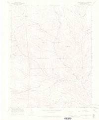
1967 Map of Lookout Mountain
USGS Topo · Published 1969About this map
The La Garita Mountains define this high-altitude landscape within the Rio Grande National Forest, where drainage networks feed into the Carnero Creek system. This late-1960s survey documents a region managed for both conservation and seasonal grazing, evidenced by the Laughlin Stock Driveway (Jeep) and the presence of the Carnero Guard Station. The map illustrates a transitional era of forest recreation, marking established sites like the Storm King Campground and Poso Campground. High peaks including Lookout Mountain and Storm King Mountain tower over numerous gulches and canyons such as Raspberry Gulch Fork and Coolbroth Canyon. Beyond the primary forest roads, the terrain is accessible via a network of primitive routes, including the Lime Creek (Pack) Trail and various unnamed pack trails and jeep trails.
Find a feature on this map
32 named features on this map. Tap any name to fly to it.
Don’t see what you’re looking for? This feature index may not catch every label — zoom into the map to look around manually.
Map Details
Editions of this 1967 Lookout Mountain Map
3 editions found
Other maps of this area

1914 · Creede
USGS Topo · 1:125,000

1915 · Del Norte
USGS Topo · 1:125,000

1916 · Creede
USGS Topo · 1:125,000

1917 · Del Norte
USGS Topo · 1:125,000

1945 · Durango
USGS Topo · 1:250,000

1953 · Durango
USGS Topo · 1:250,000

1954 · Durango
USGS Topo · 1:250,000

1956 · Montrose
USGS Topo · 1:250,000

1959 · Montrose
USGS Topo · 1:250,000

1960 · Montrose
USGS Topo · 1:250,000