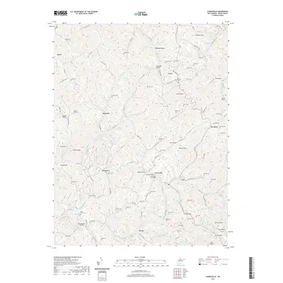
2019 Map of Looneyville
USGS Topo · Published 2019About this map
The Pocatalico River carves through the central portion of this West Virginia terrain, where the historic Looneyville Arch Bridge stands as a notable landmark. This 2019 survey documents a landscape defined by its network of hollows and ridges, such as Chambers Knob and Clover Ridge, which dictated the settlement patterns of towns like Looneyville, Clover, and Roxalana. The map is particularly dense with family and community burial sites, providing a significant resource for genealogical research. Features like the Coe-Holland Cem, Eplin Chapel Cem, and Looney Cem are scattered across the hillsides, often near the junctions of local routes like Co Rte 36/10 and Clay Rd. The distribution of these cemeteries and small hamlets like Stringtown and Rushville reflects a long-established rural social structure built around the winding watercourses of Clover Run and Summers Fork.
Find a feature on this map
131 named features on this map. Tap any name to fly to it.
Don’t see what you’re looking for? This feature index may not catch every label — zoom into the map to look around manually.
Map Details
Editions of this 2019 Looneyville Map
This is the sole edition of this map. No revisions or reprints were ever made.
Other maps of this area

1906 · Otter
USGS Topo · 1:62,500

1906 · Walton
USGS Topo · 1:62,500

1907 · Otter
USGS Topo · 1:62,500

1907 · Arnoldsburg
USGS Topo · 1:62,500

1907 · Spencer
USGS Topo · 1:62,500

1907 · Walton
USGS Topo · 1:62,500

1925 · Arnoldsburg
USGS Topo · 1:62,500

1927 · Arnoldsburg
USGS Topo · 1:62,500

1928 · Spencer
USGS Topo · 1:62,500

1954 · Charleston
USGS Topo · 1:250,000