
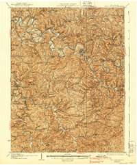
1927 Map of Arnoldsburg
USGS Topo · Published 1927About this map
The Little Kanawha River snakes through the heart of this Calhoun County terrain, carving deep bends and creating broad alluvial plains like Annamoriah Flats. In the late 1920s, this region was defined by a dense network of ridge-top and valley bottom communities, centered around the town of Grantsville and the crossroads at Arnoldsburg. The landscape is dotted with small-scale institutions that served these isolated hill farms, from the Mt Vernon Church and Walnut Grove Church to numerous one-room schoolhouses like the Annamoriah School and Tuttle Hill School.
Find a feature on this map
166 named features on this map. Tap any name to fly to it.
Don’t see what you’re looking for? This feature index may not catch every label — zoom into the map to look around manually.
Map Details
Editions of this 1927 Arnoldsburg Map
3 editions found
Other maps of this area

1893 · Sutton
USGS Topo · 1:125,000

1906 · Holbrook
USGS Topo · 1:62,500

1906 · Glenville
USGS Topo · 1:62,500

1906 · Elizabeth
USGS Topo · 1:62,500

1906 · Otter
USGS Topo · 1:62,500

1906 · Walton
USGS Topo · 1:62,500

1907 · Otter
USGS Topo · 1:62,500

1907 · Harrisville
USGS Topo · 1:62,500

1907 · Arnoldsburg
USGS Topo · 1:62,500

1907 · Spencer
USGS Topo · 1:62,500