
1907 Map of Otter
USGS Topo · Published 1907About this map
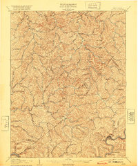
Newton and Ivydale anchor this complex landscape at the intersection of Roane, Calhoun, Braxton, and Clay Counties. The region is defined by a dense network of watercourses, where the Coal and Coke R R follows the winding path of the Elk River in the south, serving industrial outposts like Redhouse Siding and Ivydale. Settlement patterns are tightly constrained by the terrain, with small communities such as Minnora, Chloe, and Tariff established along valley floors and creek forks. Higher elevations are marked by distinctive landmarks like Desert Knob and Mule Knob, which rise above the intricate drainage systems of Big Otter Creek and Walker Creek. This topography illustrates a pre-highway era when the railway and local post offices were the primary links for these remote West Virginia hill country settlements.
Find a feature on this map
99 named features on this map. Tap any name to fly to it.
Don’t see what you’re looking for? This feature index may not catch every label — zoom into the map to look around manually.
Map Details
Editions of this 1907 Otter Map
3 editions found
Other maps of this area

1889 · Nicholas
USGS Topo · 1:125,000

1891 · Nicholas
USGS Topo · 1:125,000

1893 · Sutton
USGS Topo · 1:125,000

1897 · Kanawha Falls
USGS Topo · 1:125,000

1900 · Kanawha Falls
USGS Topo · 1:125,000

1901 · Nicholas
USGS Topo · 1:125,000

1901 · Kanawha Falls
USGS Topo · 1:125,000

1906 · Glenville
USGS Topo · 1:62,500

1906 · Otter
USGS Topo · 1:62,500

1906 · Walton
USGS Topo · 1:62,500