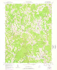
1957 Map of Walton
USGS Topo · Published 1977About this map
The Pocatalico River meanders through this portion of Roane County, anchoring a landscape defined by narrow valley settlements and high ridges like Big Ridge and Ridge. In the late 1950s, the rural character of the area is evident in the distribution of community centers such as Countsville, Gandeeville, and Walton, the latter of which serves as a hub with its Walton High Sch. The map reveals an active extractive industry through numerous Gas Well and Gas Wells labels scattered across the hollows, particularly around Harmony and the Kee Fork drainage.
Find a feature on this map
82 named features on this map. Tap any name to fly to it.
Don’t see what you’re looking for? This feature index may not catch every label — zoom into the map to look around manually.
Map Details
Editions of this 1957 Walton Map
3 editions found
Other maps of this area

1906 · Kenna
USGS Topo · 1:62,500

1906 · Walton
USGS Topo · 1:62,500

1907 · Kenna
USGS Topo · 1:62,500

1907 · Spencer
USGS Topo · 1:62,500

1907 · Walton
USGS Topo · 1:62,500

1907 · Ripley
USGS Topo · 1:62,500

1926 · Ripley
USGS Topo · 1:62,500

1928 · Spencer
USGS Topo · 1:62,500

1928 · Ripley
USGS Topo · 1:62,500

1954 · Charleston
USGS Topo · 1:250,000