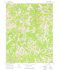
1966 Map of Tariff
USGS Topo · Published 1977About this map
Tariff and the surrounding Roane County hills are defined by a complex network of narrow hollows and ridge-top settlements during the mid-1960s. The landscape is heavily marked by the extraction of natural resources, with numerous gas and oil wells dotting the drainage basins of Henry Fork and Clover Run. Small community centers serve as focal points for rural life, evidenced by the Linden Sch and several country churches like Henry Fork Ch and Mt Vernon Ch.
Find a feature on this map
52 named features on this map. Tap any name to fly to it.
Don’t see what you’re looking for? This feature index may not catch every label — zoom into the map to look around manually.
Map Details
Editions of this 1966 Tariff Map
2 editions found
Other maps of this area

1906 · Otter
USGS Topo · 1:62,500

1906 · Walton
USGS Topo · 1:62,500

1907 · Otter
USGS Topo · 1:62,500

1907 · Arnoldsburg
USGS Topo · 1:62,500

1907 · Spencer
USGS Topo · 1:62,500

1907 · Walton
USGS Topo · 1:62,500

1925 · Arnoldsburg
USGS Topo · 1:62,500

1927 · Arnoldsburg
USGS Topo · 1:62,500

1928 · Spencer
USGS Topo · 1:62,500

1954 · Charleston
USGS Topo · 1:250,000